
Gov’t Investing In Road Network to Improve Safety and Drive Development
By: , June 19, 2023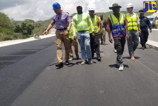
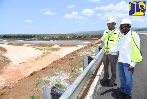
Photo: Mickella Anderson
Prime Minister, the Most Hon. Andrew Holness (left), points to something of interest while walking along a paved section of the Grants Pen roadway during a tour of the St. Thomas leg of the Southern Coastal Highway Improvement Project (SCHIP) on April 13. He is accompanied by personnel from the National Works Agency (NWA) and China Harbour Engineering Company Limited (CHEC).The Full Story
The Government of Jamaica is investing billions of dollars in improving the country’s road network, to ensure safe and efficient travel for all citizens, and create a platform for increased growth and development.
Prime Minister, the Most Hon. Andrew Holness, says the objective is to create a more seamless and connected Jamaica.
By linking farmers to markets, workers to jobs, and residents to communities and vital services, roads are the critical infrastructure on which the economy thrives and are crucial to any development agenda.
Investment in upgrading roads and highways helps to enhance workforce productivity by reducing travel time, brings business and investments to communities, leading to the creation of jobs.
“The road network is the backbone of our economy, connecting businesses, industries and individuals across the length and breadth of the country,” says Minister without Portfolio in the Ministry of Economic Growth and Job Creation, Hon. Everald Warmington, noting that roads contribute some 4.8 per cent of the nation’s gross domestic product (GDP).
Preparations are under way to implement a $40-billion road-improvement project to modernise more than 2,000 roads islandwide under the ‘Shared Prosperity through Accelerated Improvement to our Road Network’ (SPARK) Programme.
The works will entail improving road surfaces and intersections along targeted urban corridors, installing localised drainage (culverts, etc.), improving road safety through the construction of retaining walls and installation of guardrails, and installing pedestrian facilities at selected locations.
The corridors were selected based on traffic volume, the condition of the roads, safety factors such as reducing accidents or increasing emergency response times, cost, ease of implementation, and social impacts, such as increased access to services or decreased social cohesion.
The preliminary parish breakdown of expenditure is as follows: Kingston – $2 billion, St. Andrew – $2.9 billion, St. Catherine – $4.2 billion, St. Thomas – $1.2 billion, Manchester – $1.257 billion, St. Elizabeth – $1.5 billion, Clarendon – $4.087 billion, Portland – $1 billion, St. Mary – $3.2 billion, St. Ann – $3.2 billion, Hanover – $2.516 billion, St. James – $2.2 billion, Trelawny – $1.8 billion, and Westmoreland – $2 billion.
Some of the roads to be rehabilitated include Mountain View Avenue, Old Hope Road, Molynes Road, Waltham Park Road, Constant Spring to Stony Hill; Caymanas to Twickenham Park, Spanish Town to Angels, Tamarind Farm to Naggo Head; Morant Crossing to Whitehall, Airy Mount to Hampton Court, Port Morant to Bath; Caledonia Road, Spur Tree to Gutters, Williamsfield to Greenvale via Bypass; and Luana to Black River to Scotts Cove, Malvern to Santa Cruz, and Luana to Sandy Ground.
Other roads are Free Town to Four Paths, Crooked River to Pennants Douce, Whitney Town to Four Paths; Hope Bay to Orange Bay, Orange Bay to Windsor Castle, Rio Grande to Hope Bay; Halifax Bridge to Lucky Hill, Lucky Hill to Goshen, Port Maria to Islington; Alexandria to Brown’s Town, Discovery Bay to Browns Town, Ocho Rios Township; Great River to Kew Bridge, Green Island to Negril, Lucea to Green Island; Adelphi to Kent, Barnett Street to Howard Cooke Boulevard, Flankers Old Road; Albert Town to Allsides, Duncans to Long Pond, Salt Marsh to Kent; and Negril to Parish Border, Ferris to George’s Plain, and Negril to Negril Lighthouse.
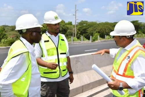
In addition to these road corridors, work is already advanced on the Southern Coastal Highway Improvement Project (SCHIP), which includes the extension of the Toll Road from May Pen to Williamsfield (Part A) and Part B (ii, iii, and iv), which entails the roads leading into Portland from Kingston through St. Thomas.
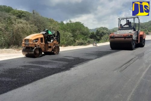
The 28-kilometre stretch, from May Pen to Williamsfield is at 93 per cent and is on track for completion by the end of August 2023.
Overall, the scope of the project includes the construction of approximately 23 kilometres of four-lane rural arterial divided highway from May Pen to Melrose Hill as well as the upgrade of approximately five kilometres of the existing Melrose Hill Bypass to a four-lane rural arterial divided highway.
An interchange in the vicinity of Clarendon Park, with a link road from the highway to the main road (A2), is also included.
After completion, the new alignment is expected to cut the current travelling time from May Pen to Williamsfield to approximately 15 minutes.
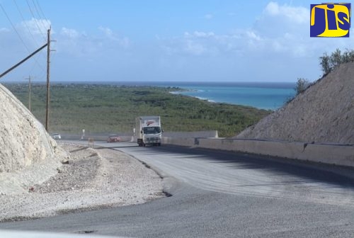
Meanwhile, in the east, the rehabilitation and resurfacing of 123.65 kilometres of existing roadway from Yallahs Bridge to Port Antonio and Morant Bay to Cedar Valley are broken down in 15 subproject packages, 10 of which are under way, are in various stages of completion and are expected to be completed in December 2023.
The final five packages are scheduled to commence in 2023/2024 and are expected to be completed in March 2025.
The over 17-kilometre stretch of four-lane roadway from Harbour View to the Yallahs Bridge is 93 per cent complete. In addition to the improved roads, the project will bring water and telecommunications infrastructure to communities between Yallahs and Prospect, and Morant Bay to Cedar Valley.
“Among the deliverables that this Government can boast about in respect of the SCHIP, is the completion of 37 bridges or box culverts, to date. We have another 14 to be completed,” Mr. Warmington informs.
He points out that there has been expenditure of US$266,206,064.45 on the SCHIP in the east, including Harbour View to Yallahs. This sum includes a capital outlay for the installation of new water infrastructure.
The other five road sections, (three in St. Thomas and two in Portland), which will complete the programme of works in the east, include the 7.74km from Prospect to Arcadia, the 7.64km Arcadia to Amity Hall corridor, and the 7.31 km Amity Hall to Hordley corridor in St. Thomas.
In Portland, the 5.16km Long Road to Manchioneal corridor and the 8.25km Fair Prospect to Boston corridor are to be undertaken.
This is a total of 36 km of “brand-new road”, says Minister Warmington, who adds that, “We are modernising the east through our infrastructural developments. The process to contract the works is now actively under way and we expect that the works, once they commence before the end of this fiscal year, will be completed by March 2025”.
Other major road projects elsewhere in the country include the Montego Bay Perimeter Road Project in St. James.
This project will span approximately 15.1 km and will involve the construction of the Montego Bay Bypass Road, the rehabilitation and expansion of Barnett Street/West Green Avenue and Long Hill Bypass, as well as a comprehensive Drainage Study of the Montego Bay Bypass area.
Additionally, the National Road Operating and Constructing Company (NROCC) is to undertake a pre-feasibility desktop study for the Hopewell/Lucea Bypass, which is aimed at alleviating traffic challenges along the northwest of the island, to move Jamaica’s major corridors further inland and to open lands to further development.
Also, three new projects will be added to NROCC’s portfolio, namely the Williamsfield to Hodges in St. Elizabeth leg of the SCHIP; the Caymanas Highway Interchange, which will connect both the North-South and East-West legs of the highway; and the North Coast Highway PPP (public private partnership) which will upgrade 60km of two-lane roadway to four, between Sea Castle and Mammee Bay.
