Government Using IT For Better Physical Planning
By: , July 22, 2021The Full Story
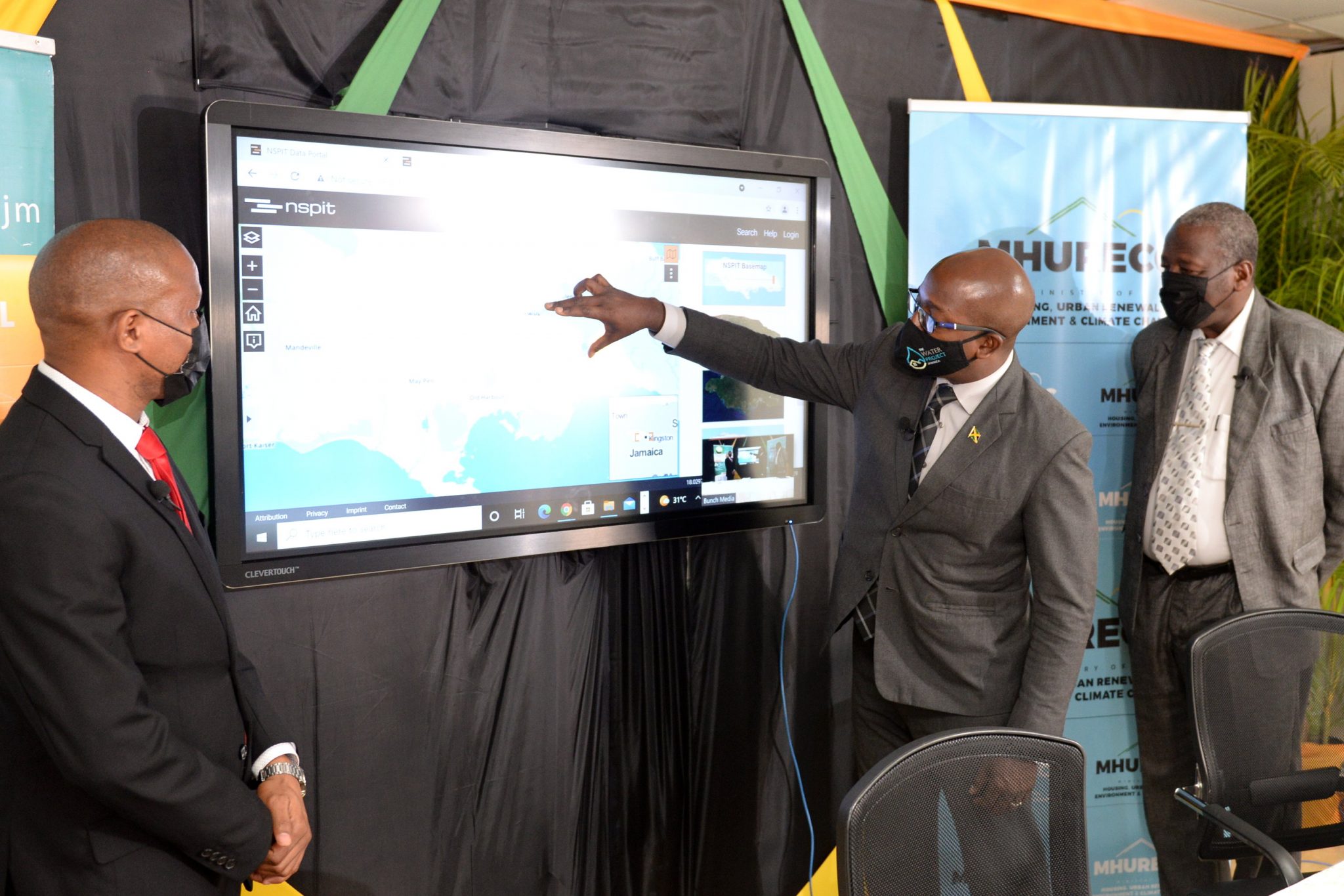
The Government’s capacity to make better planning and development decisions will be improved with the launch of the National Spatial Planning Information Technology (NSPIT) platform. The NSPIT will provide reliable, accurate and updated data on distribution of people and activities.
The platform, which was conceptualised and developed as part of the Government’s efforts to incorporate technology into planning and development as well as its business processes, was officially launched by Minister of Housing, Urban Renewal, Environment and Climate Change, Hon. Pearnel Charles Jr., during a virtual ceremony on Wednesday (July 21).
Minister Charles Jr. said the platform will ensure optimal use of the country’s natural land and marine resources and will help to roll out the National Spatial Plan (NSP) as effectively as possible.
The NSP outlines the governance framework for optimal and effective use and management of Jamaica’s natural resources for sustainable development.
“We are trying to change how we operate, how we think and, therefore, our outcomes… . This is the launch of a platform which is a part of the integral thrust for government to use science and technology, information and data to inform our decisions,” he said. The expectation is that there will be more effective and successful outcomes.
The NSPIT platform is a web-based geographic information system (GIS) tool that creates the visualisation and graphical representation of the NSP. It provides the spatial analysis and modelling functionalities to assist in planning, development, and investment decisions related to the NSP.
Mr. Charles Jr. said the platform is crucial because the NSP is the principal planning and development instrument that outlines the strategic framework for the spatial development of Jamaica for the next few decades.
“If we want to achieve national development, if we want a country where we are able to confront the challenges that we face in terms of the disaster risk, in terms of our response to climate change, in terms of how we are going to improve the use of our natural resources and manage our development, then we have to utilise technology to our benefit,” he pointed out.
The Minister said that critical sectors such as agriculture, communication, natural environment, settlements, health and infrastructure will benefit from the use of this spatial data, as it will lead to improved planning.
Mr. Charles Jr. said he was particularly pleased that the platform will also help to inform the type and scale of interventions that can be undertaken to develop more resilient settlements.
“When we speak about housing, we are no longer talking about just affordable housing…we now have to speak about affordable and resilient housing because any housing which is to fit the category of low-income earners, must also be crafted and developed with the contemplation of disasters and climate change and environmental considerations,” he said.
He noted that the platform will provide spatial analysis and modelling that developers, planners, engineers and architects can access to make better decisions.
“We look forward to all of the information… that we will get to help us to build in better places at the price point that makes sense,” he said.
Mr. Charles Jr. said he was also pleased that the country will now be able to strengthen its management of the environment and key resources using the NSPIT platform “by incorporating data on our forest reserves, our marine and terrestrial ecosystems… we are going to be able to increase our capacity to protect and preserve ecological resources for sustainable development”.
The NSPIT platform was developed by geoSYSnet, a German consultancy firm, under the Foundations for Competitiveness and Growth Project (FCGP). The FCGP is being implemented by the Planning Institute of Jamaica (PIOJ) in collaboration with Jamaica Promotions Corporation (JAMPRO) and the Development Bank of Jamaica.
The project started in the Ministry of Economic Growth and Job Creation under the supervision of the National Spatial Data Management Branch and was completed under the Ministry of Housing, Urban Renewal, Environment and Climate Change.
It was facilitated through a US$50-million loan from the World Bank to finance the FCGP which aims at strengthening the business environment in Jamaica for private sector investment.


