
Jamaicans Urged to Prepare for Hurricane Beryl
By: , July 1, 2024
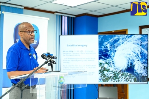
Photo: Adrian Walker
Minister without Portfolio in the Ministry of Economic Growth and Job Creation, Senator the Hon. Matthew Samuda, speaking during a press briefing at the Ministry’s offices in New Kingston on Sunday (June 30).The Full Story
Jamaicans are being urged to begin the necessary preparations for Hurricane Beryl, which is expected to commence impacting the island on Wednesday (July 3).
Minister without Portfolio in the Ministry of Economic Growth and Job Creation, Senator the Hon. Matthew Samuda, made the call during a press briefing at the Ministry’s offices in New Kingston on Sunday (June 30).
Hurricane Beryl intensified to an extremely dangerous Category Four cyclone with maximum sustained winds of 130 mph, as it courses towards the Windward Islands.
“The country needs to be very clear that we are at risk of some damage. The storm is not yet landed in the Windward Islands, but the tracks and the varying models have shown it interacting with Jamaica at some level and some degree. It’s not a time for panic, it’s a time for preparation,” Senator Samuda emphasised.
“This preparation will not be wasted. Whatever you invest in this preparation will benefit you, should the storm impact us negatively,” he added.
Senator Samuda said the Government will, on Monday (July 1), convene its Disaster Risk Coordination Committee at the Ministry of Local Government and Community Development, where Portfolio Minister, Hon. Desmond McKenzie, will provide updates.
“Post that meeting, that grouping will also brief the Cabinet at 11:00 am. I expect the Prime Minister [the Most Hon. Andrew Holness] to speak, once he has received that briefing and the situation is indeed clear. We are hoping for the best; but we’re asking you to prepare for the worst,” he stated.
Meanwhile, Director of the Meteorological Services Branch, Evan Thompson, said Hurricane Beryl is currently over the waters of the tropical Atlantic, moving closer to the eastern Caribbean and will eventually enter the Caribbean Sea.
“It is moving toward the west. Barbados is the closest island to that [system’s] centre and it is expected to move somewhat to the south of Barbados, between Barbados and Tobago, then entering the Caribbean Sea… and that is likely to start early on Monday morning,” he said.
“Now what we are seeing here is an extremely dangerous hurricane. It is already at Category Four, and it is approaching the Windward Islands. There are life threatening winds, there is storm surge that is expected. At 5:00 p.m. [on Sunday], the centre was located about 500 kilometres from Barbados. It is moving westward [and has a] central pressure of 960 [millibars (Mbrs)], which shows that it is a very intense system. The lower the pressure means the stronger the system,” Mr. Thompson added.
Regarding the track projection, the Director said the hurricane will approach the central Caribbean during the day on Tuesday (July 2) and is expected to remain south of Puerto Rico and Hispaniola.
“As we move to Wednesday (July 3), that’s when the approach is likely to be much closer to Jamaica. As the system is moving westward, what is being projected now is that there will be a bit of weakening of the system, and that is because the conditions in the Western Caribbean are not as conducive to the development, as it has been over the Atlantic and will be in the eastern Caribbean,” he stated.
“So they are expecting that there will be some weakening. How much weakening is not very sure because, at the end of this forecast period, the accuracy is likely to shift from time to time, because it is not as sure, the farther you are from the time that the prediction is made. So, it is possible… the centre of that system, although it is pinpointed in the middle of the cone, it could be on the right-side end or on the left side end of that cone,” Mr. Thompson added.
He further stated that the centre of the system could be farther from the south coast of Jamaica, or it could be over the waters to the north of the island as it passes the country.
“So right now, there is some… uncertainty as to exactly where that centre will be. Just to point out… a Category Two hurricane goes up to 110 mph, and a Category Three between 111 and 129 mph. So, it’s likely to move from about a Category Three to Two, which would be good news for us,” Mr. Thompson said.
“Also, what would be good news for us is, if the centre of the system is further from the south coast, [its] moving more over the Caribbean Sea and away from the land area is something that we are hoping we’ll see develop over the next day or two. At this point in time, we have not declared that this is a threat to Jamaica. It could very well pose to be a threat right now; this is a risk that we have to manage.
“Tomorrow [Monday] morning, we’ll be able to assess this and determine whether we consider it a threat, now that it is about entering the Caribbean region, and whether there is a sustainability in the forecast models that are projecting this system and whether it maintains the position as it is showing at this time,” he added.
Mr. Thompson further stated that Jamaica is at risk of experiencing heavy rainfall as the system moves closer to the country, as well as strong winds, storm surge and landslides.
“We’re still hoping that the projections, moving forward, will show further weakening, likely in the central Caribbean. But that it will also show a drift away from the southern coastline… that is the best-case scenario. But the worst case, which is what we should prepare ourselves for, is having a major hurricane moving right across the island of Jamaica on Wednesday,” the Director said.
