

PM Urges Greater Use of GIS for Economic Growth
By: , October 11, 2017The Key Point:
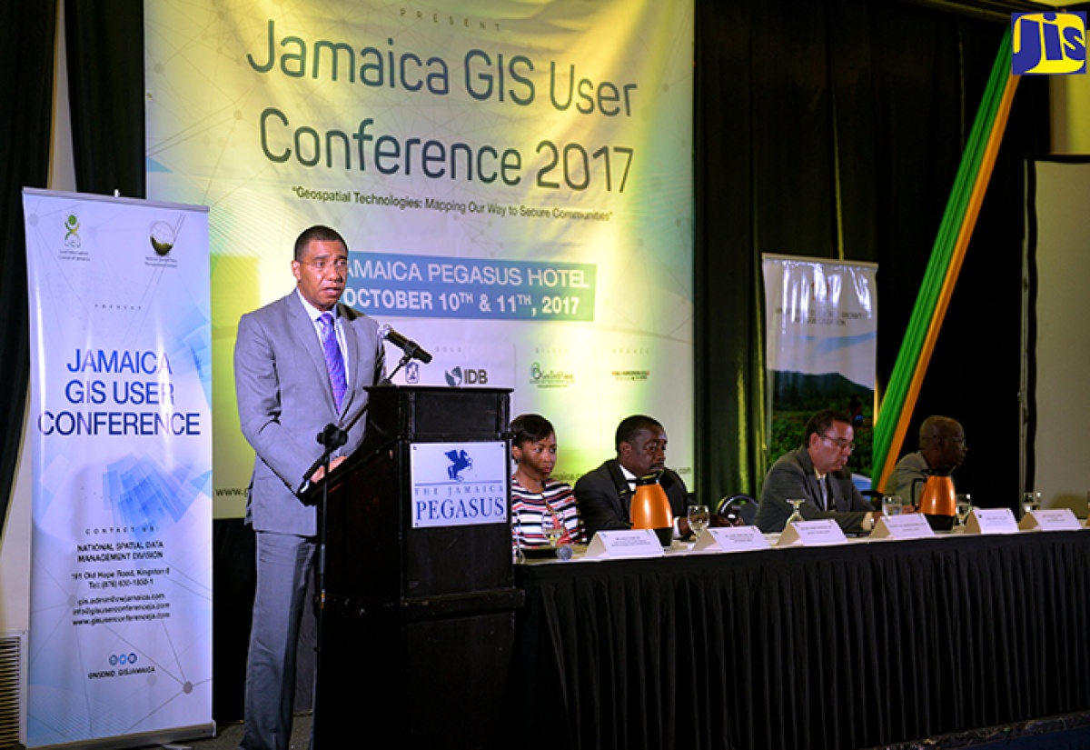
Photo: Yhomo Hutchinson
Prime Minister, the Most Hon. Andrew Holness (left), delivers the keynote address during the opening ceremony for the two-day Jamaica Geographic Information System (GIS) User Conference held at The Jamaica Pegasus hotel in New Kingston on Tuesday, October 10. The conference is being jointly staged by the National Spatial Data Management Division (NSDMD) and Land Information Council of Jamaica (LICJ) under the theme ‘Geospatial Technologies: Mapping Our Way to Secure Communities’ and forms part of activities commemorating the LICJ’s 25th anniversary. Seated (from left) are President, Urban and Regional Information Systems Association, Caribbean Chapter, Valerie Grant; National Security Minister, Hon. Robert Montague; Minister without Portfolio, Ministry of Economic Growth and Job Creation, Hon. Daryl; and President, Spatial Innovision Limited, Silburn Clarke.The Facts
- Mr. Holness said the Government has been making significant investments in using GIS technology to spur Jamaica’s growth and development while seeking to reposition the country as a knowledge-based economy.
- Another key area of investment, the Prime Minister highlighted, was the National Identification System (NIDS), which will provide a comprehensive and secure structure to capture and store the personal identity information of all citizens.
The Full Story
Prime Minister, the Most Hon. Andrew Holness, is encouraging greater use of geographic information system (GIS) technology across all sectors in order to spur higher levels of economic growth and development.
He contends that despite Jamaica’s use of the technology over the past 25 years, its full potential remains untapped.
“It is certainly accepted by the Government… definitely at the administrative and executive levels. But we have still not yet moved to the point of utilising the technology where we leverage (its) predictive powers… which is to use it in a way to either prevent things from happening or facilitating things we want to happen,” the Prime Minister noted.
He called for its utilisation at the decision-making level “as a management and planning tool”.
He was delivering the keynote address at the opening ceremony for the inaugural two-day Jamaica GIS User Conference held at The Jamaica Pegasus hotel in New Kingston on Tuesday (October 10).
Mr. Holness said the Government has been making significant investments in using GIS technology to spur Jamaica’s growth and development while seeking to reposition the country as a knowledge-based economy.
These, he said, have been in the notable areas of job creation, with the establishment of the GIS Corps of National Service targeting unattached youth under the Housing, Opportunity, Production and Employment (HOPE) initiative, and the installation of key infrastructure designed to enhance public safety and security.
Mr. Holness said that under the GIS Corps, youngsters have been employed by several State entities to undertake a number of key engagements.
These, he said, include at the National Water Commission (NWC) to carry out asset mapping of all meters islandwide, the collating of data for an asset map capturing street lights, with another corps being established to assist in generating rainfall data for the National Meteorological Service.
The Prime Minister said that there were numerous other opportunities for youth employment utilising GIS technology to document Jamaica’s critical assets.
He noted that significant investments have also been made to install surveillance cameras and closed-circuit television (CCTV) to capture illicit criminal activities and traffic breaches, as part of the Government’s undertaking to engender a safe and secure society.
Another key area of investment, the Prime Minister highlighted, was the National Identification System (NIDS), which will provide a comprehensive and secure structure to capture and store the personal identity information of all citizens.
Mr. Holness contended that a system to accurately identify persons will go a far way in generating information that facilitates analyses of the society’s challenges, and potentially yield solutions and predict outcomes.
“We truly understand the deep power of the technology, and that it can be leveraged for the economic and social development of the country,” he added.
The GIS User Conference is being jointly staged by the National Spatial Data Management Division (NSDMD) and Land Information Council of Jamaica (LICJ) under the theme ‘Geospatial
Technologies: Mapping Our Way to Secure Communities’.
It forms part of activities commemorating the LICJ’s 25th anniversary.